The best ride ever. That’s what they call the St Helens to Strahan trailbike ride, a four-day adventure from St Helens on the east coast of Tasmania to Strahan on the wild west. It’s a bold claim but let’s look at the facts: 720km of Tasmania’s best trails, military-like organisation of fuel stops, food, accommodation, transport and support, GPS guidance, exclusive access to some of Tasmania’s most remote and untouched riding spots and two free beers every night. So what’s the catch? You have to spend five days with 50 Tasmanians…
The ambitious title started as a joke between a group of mates who all thought their ride was the best ever. Some were based in the east, some central and others in the west. So they joined them all up to create a 720km route from St Helens to Strahan. This became the “best ride ever”. But the concept originated before the clash of the Tassie trail bosses.
In 2006, after a few bourbons, event creator Andrew Gray whipped out a pen and drew a line from St Helens to Strahan on a map on the back of a phone book. It then took the team of locals with expert knowledge of all the different parts of the state to connect the dots, Ben Wilson to organise the lot and now, over a decade on, the ride is stronger than ever.
DAY 1: ST HELENS TO BRIDPORT
My flight to Launceston was delayed. Heavy fog blanketed Launceston and we couldn’t take off until it cleared. Two hours behind schedule, the wheels touched down in Tassie and I was in a car with support driver Dale on my way to St Helens. Trailing behind was the Honda CRF450L which would be my steed for the four days.
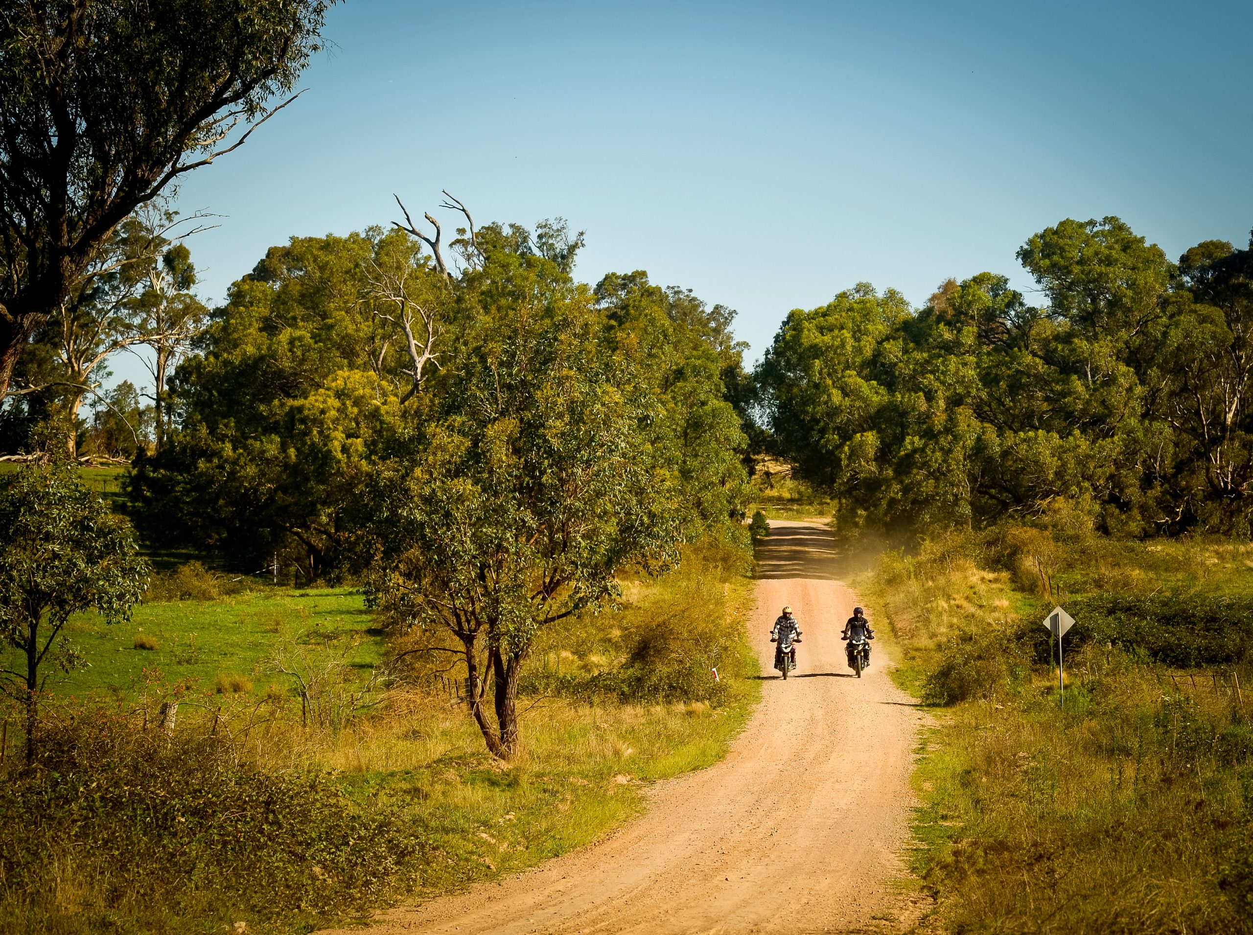
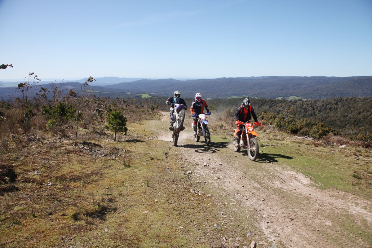
Despite Dale’s best efforts to make up the lost time, we missed the big departure procession down the main street of St Helens. I geared up and, after a quick introduction to my team, three locals who help map the route; Tommo, Craig and Chris, I threw a leg over the 450L and we were on our way to Strahan! The ride is designed to be tackled in teams.
When you register, you form your own group. There has to be at least one GPS per team and that way it breaks up the crowd, keeping dust and waiting time down.
Settling into the first hours of a four-day trailride you have to change your mindset. You aren’t cutting Braico-style hot laps around the jizz rut, you need to pace yourself. We had 130-220km to cover each day and the last thing I wanted was to injure myself. You never know what they’ll do to you in a Tasmanian hospital once they find out you’re from the mainland.
A few hours into the ride we caught a group of Suzuki DR-Z400 riders who had called themselves “Doctors on Doctors” and were dressed accordingly. We managed to catch the trio despite starting an hour behind because one of them had crashed in a big way.
With no real doctors around, injured rider Eliot rode out one handed before being picked up and taken to hospital. The other two, Tim and Andrew, stayed with us.
I discovered I was wrong to assume they had called themselves the doctors simply because they were riding DR-Zs. Tim explained that during the application process he spent over an hour applying for the necessary AMA insurance on the Australian Medical Association website instead of the Australian Motorcycle Association one.
Eliot’s crash wouldn’t be the last problem the doctors would face on day one. Only 30 minutes down the trail, Andrew tipped over in a mud puddle and his bike wouldn’t start. We tried everything to get it going but nothing worked and, eventually, Tim pulled out the tow rope and dragged his stranded mate out of the forest.
Tommo, Craig, Chris and I rode ahead to call the support truck but as we were triangulating our position, flying out of the bush came Andrew coasting down the 1.2km hill in what would become the world’s longest clutch start attempt. His DR-Z coughed to life sounding like a 75-year-old pack-a-day smoker but it was running.
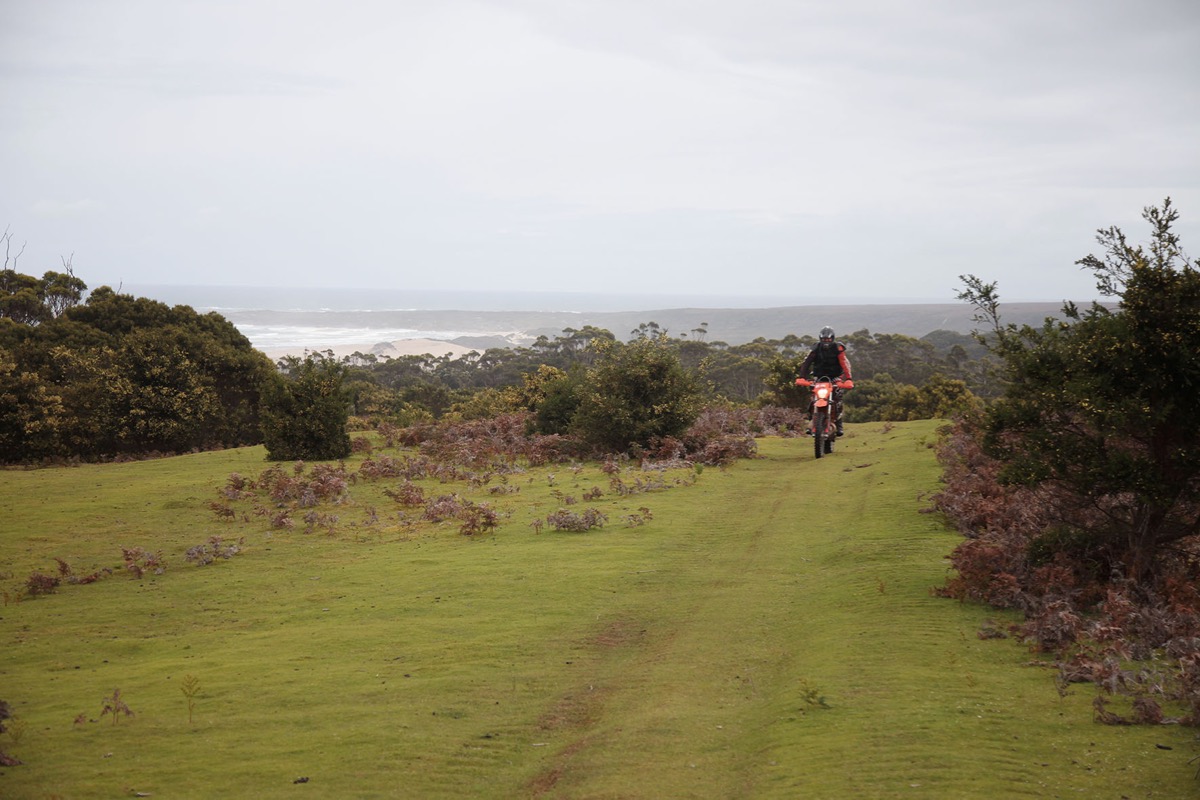
Given the distances we had to cover each day, the trails were pretty easy going. A mix of flowing fireroads and some narrower twin track but no tight singletrack, not on the first day at least.
The curse of the doctors struck again when Tommo’s chain snapped while we were all charging up that long hill. Luckily these Tassie trailriders are well prepared with spare links and we were on our way in a matter of minutes.
The last section of the 170km day was sandy, whooped out singey. Not the Honda CRF450L’s domain but it charged along without complaint. It was nearing six o’clock by the time we enter the section so I was feeling pretty smashed and was happy to make it to Bridport for the night stopover at about 7.30.
DAY 2: BRIDPORT TO GOWRIE PARK
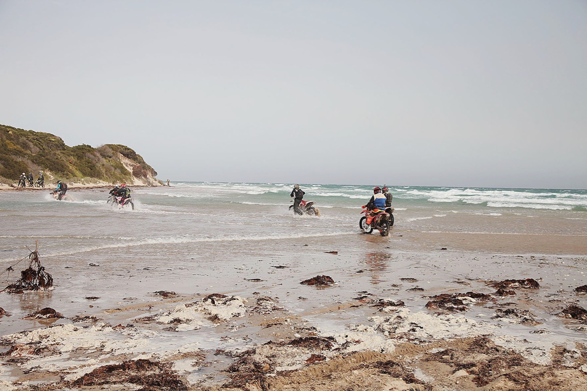
This was when the fun really begun. The first section was a mad dash down the beach and the big Honda was in its element. Just getting onto the beach was hard work but, after smashing my way through a few kays of sand whoops, we emerged only to find there wasn’t any beach, only a couple of metres of dry sand before huge sand dunes rose up overhead.
We had unfortunately timed our run to coincide with the biggest king tide to hit the area in years. I didn’t know any different but the locals all told me that usually the beach is 50m wide and you can hold 110kmh.
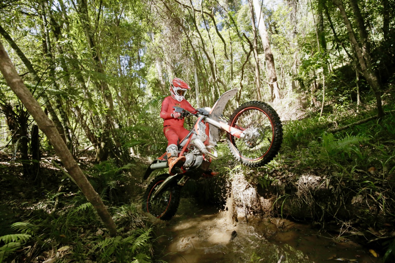
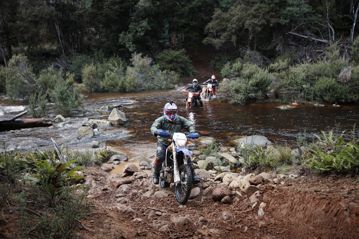
Seven kays down the beach we caught up to the rest of the pack, who had stopped at a river crossing that was swollen thanks to the tide. It went against our instinct but the best way to cross was closest to the waves, because that was where the water was shallowest. I waited for a lull in the sets, clicked second and held the CRF450L pinned across the 15-metre-wide river mouth which was still as deep as the airbox. It was super sketchy but I made it across.
This river mouth is usually only a couple of inches deep. None of the locals had ever seen the beach underwater and the river so deep and wide. I just thought these blokes love riding their $14,000 dirtbikes through saltwater three feet deep … It was testament to how tough dirtbikes are.
We left the beach behind and headed up into the hills near Bellingham where there was less saltwater and more flowing trails. Craig led the charge and we weaved through the mountains at a pretty good pace, only stopping to turn around when we got lost, even though Craig had mapped the route!
One turnaround saw me drop the CRF450L and snap the front brake lever which made the remaining 100 or so kilometres of the day a bit hairy, especially given my rear brake pads were metal on metal by this point.
Despite the slow start to the day thanks to the unpredictable nature of Poseidon, the pace picked up throughout the day and by the time we made it to the night’s stopover in Gowrie Park we had clocked over 220km.
DAY 3: GOWRIE PARK TO WARATAH
It rained all night and didn’t stop as we geared up and left for our 130km ride. Luckily I’d had the bright idea to buy a thin rain jacket the night before the trip, a $15 purchase that probably saved me from dying an early death. I was a little worried about what was in store for day three, especially after a full night of heavy rain, because I’d heard stories about how tough the day three hills were in the wet.
It must have got to my head because not even a kilometre into the day I put the big Honda down on an easy hill – I was in for a long day. The rain continued to fall as the kays ticked over and I was slipping all over the track, I just couldn’t keep the bike in a straight line. I stopped to check my tyre pressures, 20psi … that’d be why. In my rush to leave St Helens on the first day I never gave the bike a check over, which turns out was running MotoGP tyre pressures. I let out a few pounds and things got a lot better.
The trails we rode for the morning started life as access tracks once used for logging. Although they weren’t tight singletrack, they were still tricky to navigate because of fallen branches that would put you on your arse if you weren’t paying attention. The St Helens to Strahan crew have built a few bridges along the trails to make crossing some of the deep washouts a lot easier.
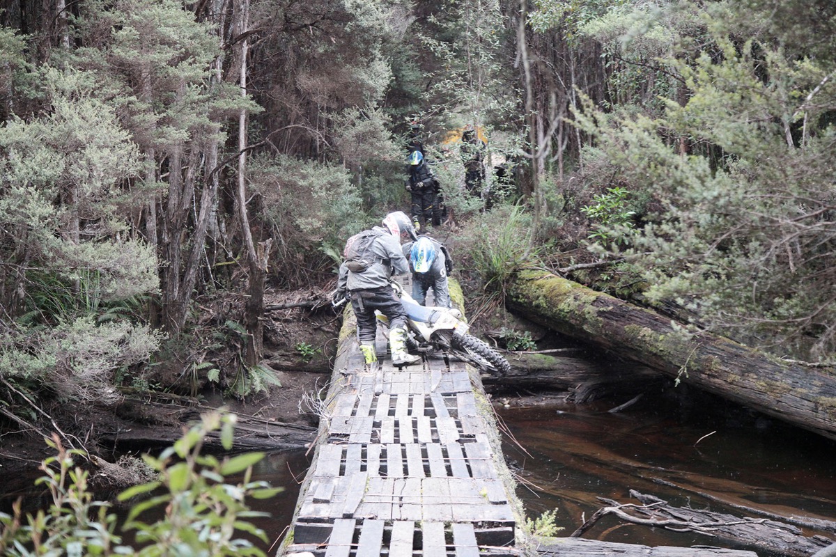
The bridges are made from shipping pallets nailed to logs and because the area gets a lot of rain and not much sunlight, they were covered in moss and slippery as ice. The longest bridge spanned a river about 10m wide. When we arrived someone had just fallen into the water when their bike slipped out from under them so the rest of us decided to push our bikes across. Someone still almost lost their bike pushing it across.
The infamous clay hill I had heard so much about turned out to be an anti-climax. In past years’ people have struggled to make it up the slippery little sucker which is littered with tree roots, but for some unknown reason there was a lot of grip and everyone got straight up. After this the trail got a lot tighter and we entered what was the most technical section of the ride. It wasn’t anything too difficult but, compared to the flowing access trails we had been riding, it was much slower going. The trail was covered in rocks and full of mud holes that could drown your bike if you weren’t careful.
We made it through but the rain continued to fall. To make things worse, the temperature was dropping to near arctic levels. Following our singletrack session we had a 30km road section to where we were staying for the night in Waratah. This was without a doubt the coldest 30 kays I’ve ridden in my life! It was six degrees and raining, in late October!
What the hell is going on Tasmania? It was character building, if nothing else. Most of us couldn’t even undo our helmet straps when we arrived because our hands were so cold. But the fire inside the pub was roaring and everyone suffered the same bone-chilling experience, so it gave us something good to talk about.
Rider’s briefing the night before the final day had a serious tone. I had heard all week about the dangers of the west coast. The main message was never turn your back on the west coast or you might just end up losing your bike, or worse.
DAY 4: WARATAH TO STRAHAN
Despite the semi-terrifying warnings, I was looking forward to day four the most. I had heard good things about the west and I was pumped to ride down the treacherous Ocean Beach. I’d been hearing all week about its perils.
A quick blast along the black top started our day’s riding. It was freezing, I had no idea Tasmania got so bloody cold in spring. I’ve got no fat on me so my core body temperature was still borderline hypothermic from the day before but one of the locals, Chris, was kind enough to lend me his hi-vis mining jacket.
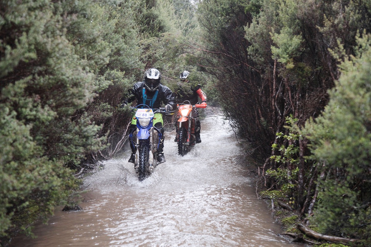
After a few kays on the tar we turned onto a trail which never sees daylight, so you can imagine how slippery it was. We crossed a river at the bottom and things got a lot tougher on the way out. Some time ago the river burst it banks in severe flooding and decided it would rather flow down the access track.
This meant we essentially had to ride up a river to get out of the valley and after all the rain we’d had the past few days it was not easy going. There were railway sleepers hidden underneath the brown, turbulent water and any wrong step would see you and your bike drop into a hole.
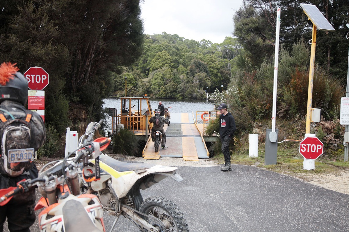
It was the worst conditions any of the locals had ever seen, and some of them had done the ride every year since it started in 2006. The end of this trail marked the start of a long transport to the Pieman River Barge. Across the Pieman River was the start of the real Tassie West Coast and, in my books, the best section of the trip.
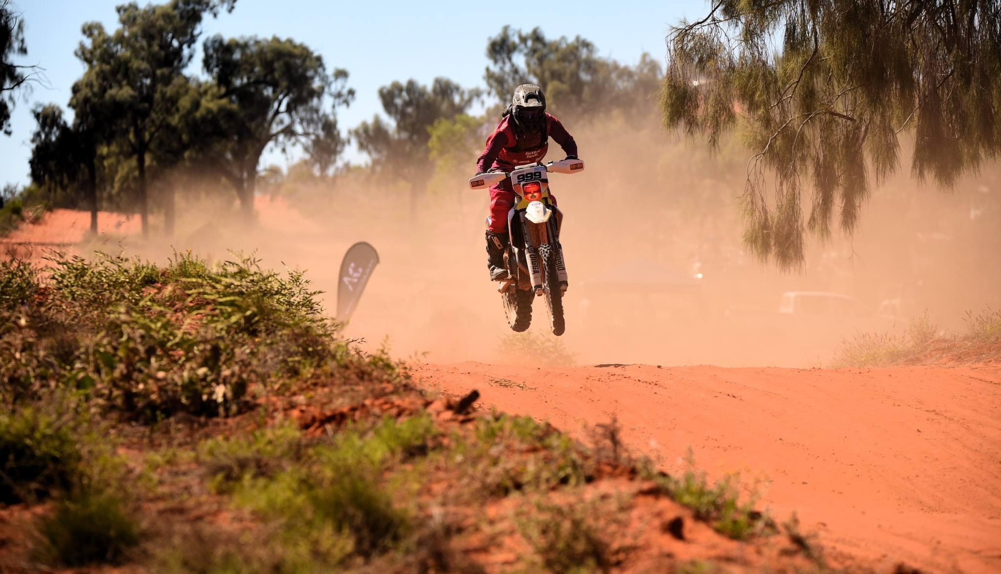
We made our way to the coast through a farm access road that was full of mud holes that caught a few riders off guard. Not the mighty Honda though! With so much inertia it ploughs through mud holes like an ice breaker through the Antarctic ice shelf! After smashing our way through countless puddles, the terrain opened up and I caught my first glimpse of the coast. It was looking rough and wild but against the bright green grass of the farm it looked unreal.
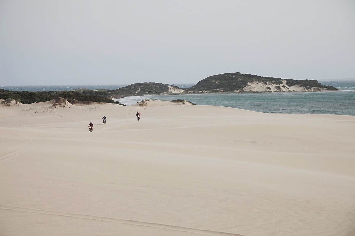
The farm track dropped us off north of Grandville Harbour and a few kilometres of flowing sand tracks guided us to the start of one of Tasmania’s most famous 4WD routes, Climes Track, 20km of torture as some riders put it. Climes is a rocky track that links Granville Harbour and Trial Harbour. It’s a fair workout on body and machine and a hotspot for flat tyres and dented rims.
My group made it without a single puncture and we fuelled up one last time before we attempted the most treacherous section of the ride, Ocean Beach. Four bikes were written off one year on Ocean Beach when a storm surge pushed riders up against the near vertical 20m sand dunes.
At the start of the ride the weather forecast didn’t look good. Another king tide combined with 4m swells gave us little hope of riding the final section to Strahan on the beach. Plus, heavy rain in the area would mean the Henty and Little Henty rivers would be raging, and we had to cross both! Only three times in the 12-year history of the event had riders made it across the two rivers. Getting down to Ocean Beach through Trial Harbour was easy enough and once on the sand it feels like you’re on another planet.
Only a couple of kilometres down the beach is the mouth of the Little Henty. Despite its name, the Little Henty is usually the bigger of the two and on this day it was almost impassable. In previous years they have carried bikes across and that’s what we did. Event regular Hayden left us little choice, we were crossing the river one way or another. At just over two metres tall it’s hard to disagree with Hayden.
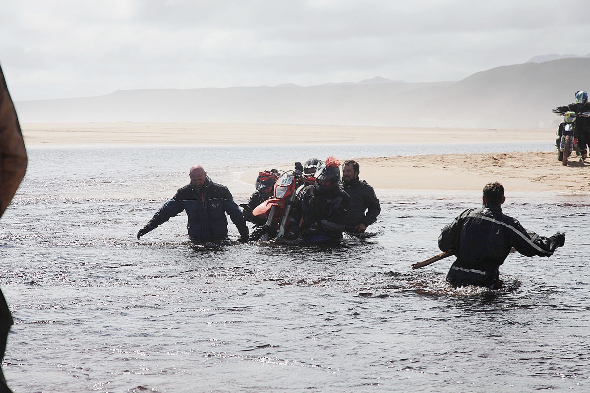
Four people to a bike we hauled 15 bikes across, not knowing if the Henty, 10km down the beach, would even be passable. With all the bikes across we blasted down the beach towards Strahan. Conditions were perfect. Despite the big seas, the waves were staying well away and it was sixth gear wide open until we arrived at the Henty River.
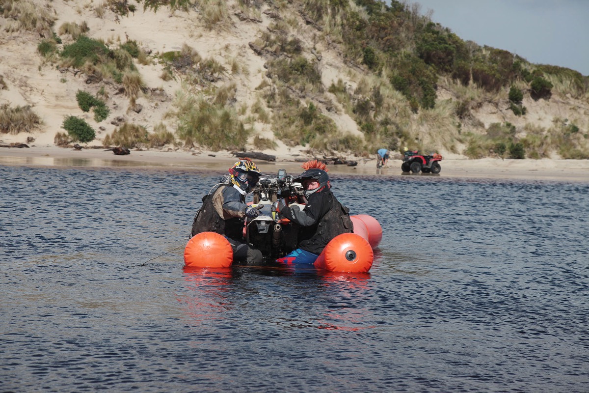
To our horror the Henty was wider and deeper than anyone had ever seen it. There looked like no way across. A few riders tried to cross at the mouth through the breaking waves but three of them drowned their machines.
But then out of nowhere appeared three locals on quad bikes. They had come from our direction but we had no idea how they’d got their quads across the river. We flagged them down for a chat and to our amazement they revealed a homemade inflatable raft which they use to cross the river.
These three legendary Tasmanians had no hesitation lending us their raft to get our stranded bikes and bodies across. It was an experience I’ll never forget, pushing off from the riverbank with only some PVC pipe stretched between two inflatable tubes keeping me and my Honda from sinking to the depths of the river. Crossing the Henty was the final hurdle before we could blast down the last 15km to Strahan. Cold beers and a mega BBQ greeted us in Strahan and we were buzzing all night from our epic final day adventure. Yep, the best ride ever.
The Deal
COST: $1489
WHEN: 22-26 October, 2020
WHAT’S INCLUDED: Everything! Just bring your own bike and riding gear. Fuel, food, drinks accommodation, GPS route and transfers to the starting point and from Strahan after the ride are included in the entry fee.
WHERE: Starts in St Helens, finishes in Strahan, with bus back as far as Launceston and truck for the bikes.
HOW LONG: Four days of riding, one day to get home from Strahan.
The ride attracts 50-70 riders each year but in 2018 they added an adventure route for the latte lovers and a one-day, ironman-style St Helens-to-Strahan challenge. That’s 800 kays of trails in less than 24 hours. Organiser Andrew Gray initially offered $1000 to any group who could do the run in less than 24 hours. Four riders did and now it’s a regular thing.
WEB: sthelenstostrahan.com.au
EMAIL: sthelenstostrahan@gmail.com